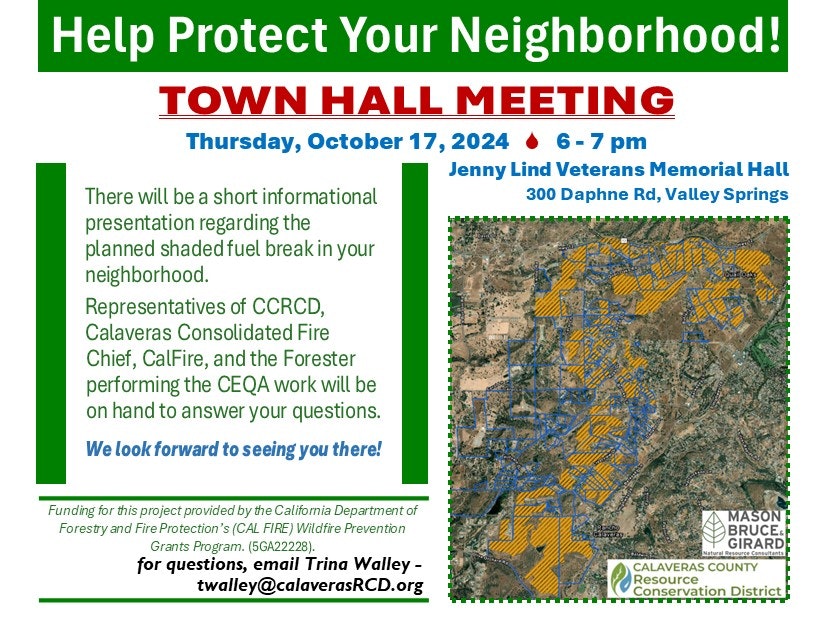
Information Covered at Town Hall Meeting
NW Calaveras Fuel Reduction Project
Project Goal:
To mitigate the potential of wildfire ignition in the project area and to slow the intensity and rate of spread in case ignition does occur. Wildfire in foothill communities can start and spread rapidly. While they often start fast and are put out quickly, low elevation fires can be erratic and can burn at high intensity – increasing the potential for devastating impacts to surrounding communities.
This project will reduce the risk of high-intensity, high-severity wildfire and most importantly, will help to protect life and property in the Calaveras County communities of Quail Oaks and Rancho Calaveras, southwest of Valley Springs.
Project Details:
1143 acres have been identified as suitable and appropriate for this phase of fuel reduction treatments. Final treatment units will be selected based on a combination of the following:
- High landowner participation
- Ease of access (road access, terrain, protection areas)
- High vegetation density
- Implementation cost will determine total acreage treated
- The map below depicts the 1143 suitable acres in orange and the parcels which are not currently involved in the project, outlined in blue.
- If your property has a blue outline, CCRCD has not received a signed Right-of-Entry (ROE) from you.
- Blue outlined properties that include orange treatment area are of top priority to receive ROE in order to implement this project.
- If you have neighbors that are not here and have not signed and returned a ROE form, PLEASE encourage them to join this important project!
- CEQA analysis is well underway and will be completed once all participating properties are known.
- CCRCD will put this project out to bid as soon as CEQA documentation is complete and approved.
- As part of CEQA, a public comment period will occur. Please show your support for this project by writing a support letter during this period.
- CCRCD hopes to see implementation begin before the 2025 fire season begins.
- Large trees over 12” diameter (measured at 4.5’ from the ground) will generally remain in the project area and will be limbed to a height of 10 feet.
- Trees smaller than 12” diameter will generally be thinned to a 35-foot spacing.
- Trees and brush that meet the specification for treatment will be masticated into shreds/mulch and will be distributed across the surrounding area.
- The following protection measures will be implemented to mitigate any potential cultural or environmental impacts:
- Archaeological and biological surveys will be conducted to confirm the presence/absence of cultural resources and protected species of plants and wildlife.
- Please Encourage Community Members to Join this Wildfire Fuel Reduction Effort
- Equipment will be excluded from sensitive areas such as watercourses, steep slopes (>45% slope), and areas determined to have sensitive resources.
- Operations will cease during periods of significant rainfall and will be subject to a drying period to prevent soil compaction.
Project Funding:
Funding for this project provided by the California Department of Forestry and Fire Protection’s (CAL FIRE) Wildfire Prevention Grants Program. (5GA22228)
The Project Manager and Project Foresters listed will be available to address landowner concerns and to ensure that a smooth operation occurs.
Please contact Dan Liechty, Jeb Brooks, or Rubie Teffeteller during business hours (8a.m. to 4p.m.) with questions or concerns.
PROJECT MANAGER:
Dan Liechty (209) 419-1244
REGISTERED PROFESSIONAL FORESTER:
Jeb Brooks (209) 459-9259
ASSISTANT FORESTER:
Rubie Teffeteller (209) 540-6036
EXECUTIVE DIRECTOR:
Trina Walley (209) 226-0039
Please Encourage Community Members to Join this Wildfire Fuel Reduction Effort
Thi s link is a printable version of the above information.
NW TH Handout.pdf


